


Mien app for iPhone and iPad
Developer: Robert Atherton
First release : 25 Sep 2017
App size: 3.07 Mb
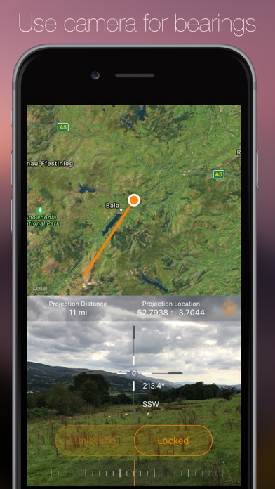
Mien is a simple app which uses the device screen as a viewfinder to take a bearing, just like a prismatic compass. The app then draws this bearing onto a map, so you can see what features you are looking at.
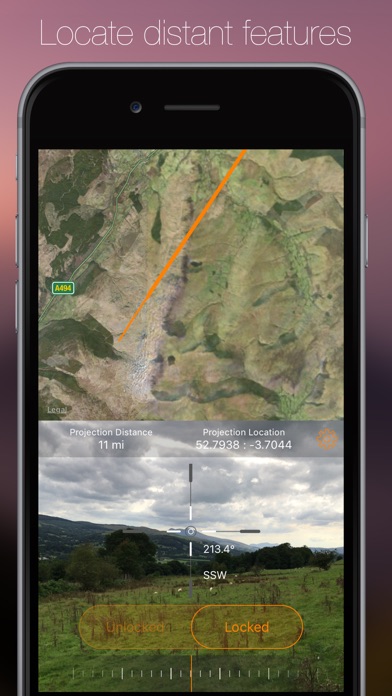
The app is useful when working out what a geographical or architectural feature is in the distance.
You can also import and visualise geographic data from GeoJSON files.
To use just tap the play button or the middle of the viewfinder. The app will then turn on the camera and begin to use the device GPS capability to determine your location. When you have your feature in your sights tap the stop button or the graticule in the centre of the viewfinder. Tap the little map in the viewfinder to show a map full screen.
You can start and stop the device from the full screen map by tapping the play button. You can also change the map type and switch back to the viewfinder from here.
There is a graded slider at the bottom of the screen which determines how far out the bearing is to be drawn and the app displays the point at which the drawn bearing ends in GPS decimal coordinates. The other slider controls the level of zoom in the viewfinder.
In the settings menu the distance to the projected point can be entered manually as centimetres. The projection distance can also be set in the full screen map view by tapping and holding, then moving your finger around, which manually sets the projection location and projection distance. The updated heading is displayed above. The newly set projection distance remains even when you hit play and use the viewfinder. The heading can be displayed in degrees, radians or NATO mils.
Please note: continued use of the app with the compass and GPS on will use a considerable amount of battery power. This is because the app needs your location as accurately as possible in order to draw the bearing onto the map. The app doesnt use the camera or GPS system when it is in the background. In addition the app will require a data connection to display map and satellite imagery. It should be noted that this app should not be used as an emergency tool and its accuracy is directly dependant on the accuracy of the GPS system within the device.